An Exceptionally Rare 18th Century Plan of Madrid by Tomás López


[Click image to view in new window, left or right arrow to see previous or next image.]
An Exceptionally Rare 18th Century Plan of Madrid by Tomás López
Published in 1785 in Madrid.
Dimensions (Unframed):
Height: 65 cm / 25.5 Inches
Width: 94 cm / 37 Inches
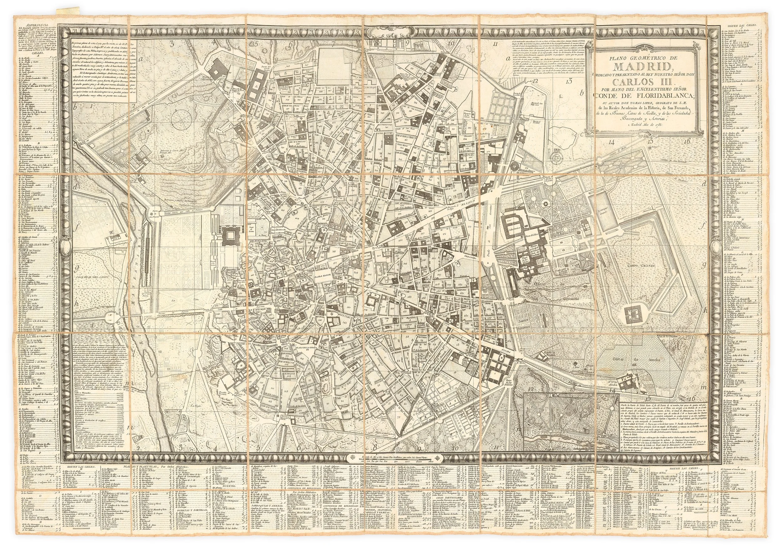
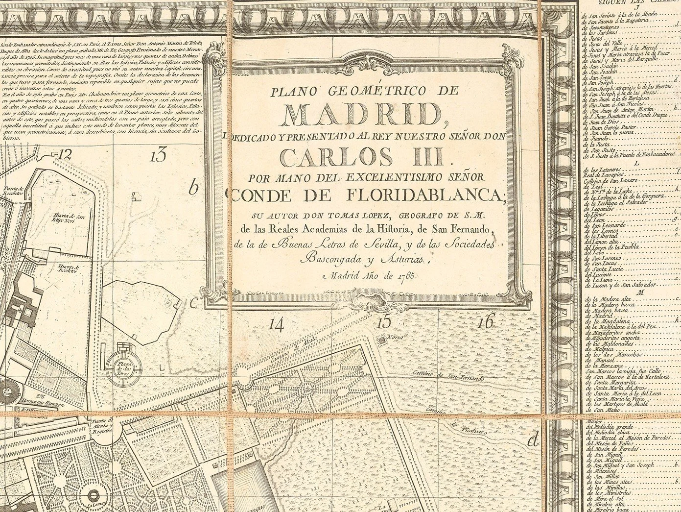
A monumental and highly detailed plan of Madrid, engraved in 1785 by Tomás López, Royal Geographer to King Carlos III, and dedicated to the monarch through the Count of Floridablanca. This large-format map captures the Spanish capital at a pivotal moment of Enlightenment-driven urban transformation, serving both as an administrative document and a practical urban directory.
López provides an unusually transparent account of his sources in extensive engraved notes across the map. He traces Madrid’s cartographic tradition from the seminal 1656 plan by Pedro Teixeira (engraved in Antwerp by Salomon Savery), through its 1683 reduction by Santiago Ambrona, and later works including the 1761 Paris engraving by Chalmandrier and the 1769 plan by Antonio Espinosa de los Monteros. López goes further, stating that he personally verified uncertain areas through direct measurement and incorporated newly constructed churches, gardens, and civic buildings—establishing this edition as the most authoritative representation of Madrid in the late eighteenth century.
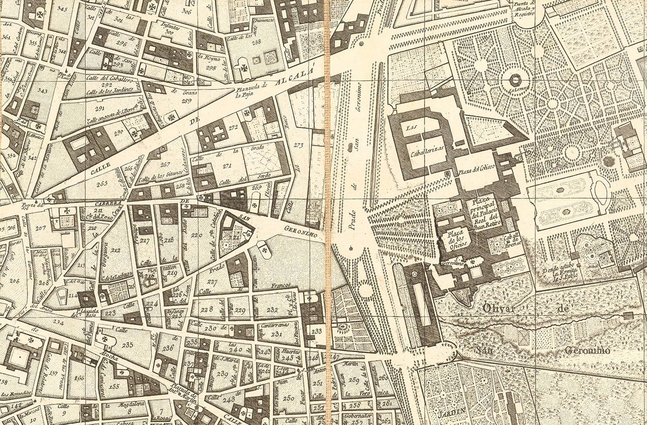
The plan is organized using an alphanumeric grid system, enabling precise cross-referencing to the extensive multi-column index that fills the margins. Streets, plazas, convents, and public institutions are meticulously recorded. Built blocks (manzanas) are clearly distinguished from open spaces, while key urban features—such as the Retiro Gardens, the Paseo del Prado, and the Campo Grande—are prominently depicted. A supplementary inset extends coverage southward to include the Puerta de Toledo, the Manzanares River, and the Puente de Toledo.
Madrid under Carlos III:
Produced during the reign of Carlos III, this plan reflects a period of sweeping civic reform. The King’s initiatives in paving, sanitation, and urban planning—referenced directly in the map’s notes, including the royal decree of 1766—transformed Madrid into a modern European capital. The dedication to the Count of Floridablanca underscores the map’s connection to the reformist Bourbon administration, whose ambition was to elevate Madrid to the standards of Paris and London.
Significance:
This 1785 plan stands as one of the most important and comprehensive Enlightenment-era maps of Madrid—remarkable not only for its scale and precision, but also for its documentary insight into the city’s modernization. Its combination of rigorous survey work, historical synthesis, and practical indexing makes it both a landmark cartographic achievement and a vivid record of eighteenth-century urban life.
PRICE: £4,400


