A WONDERFUL MID 19TH CENTURY GEOLOGICAL MAP OF THE BRITISH ISLES BY KNIPE (James A)
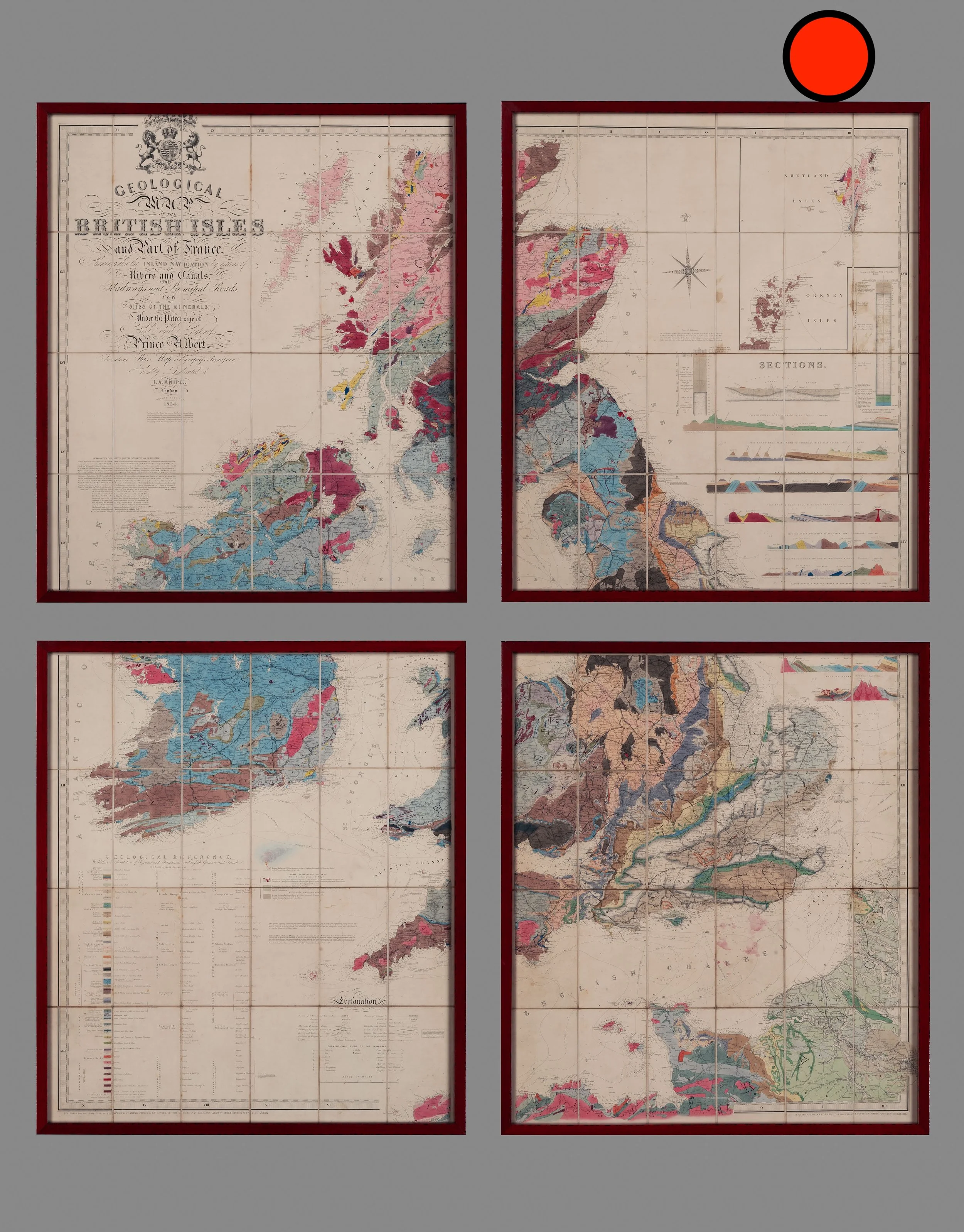
A WONDERFUL MID 19TH CENTURY GEOLOGICAL MAP OF THE BRITISH ISLES BY KNIPE (James A)
SOLD
Dimensions framed:
Height 155cm
Width 134cm
(We have had this map framed in a black lacquer frame with conservation mounts and glass)
Published 1854.
Original colouring.
Condition, very good.
A rare geological Map of the British Isles and part of France, Showing also the Inland Navigation by means of Rivers and Canals, The Railways and Principal Roads and Sites of the Minerals, under the Patronage of His Royal Highness Prince Albert.


