A LARGE 19TH CENTURY MAP OF LONDON


[Click image to view in new window, left or right arrow to see previous or next image.]
A LARGE 19TH CENTURY MAP OF LONDON
Stanford, Edward (1827–1904) — Map of London and its Environs (1878).
Date: 1878
Dimensions: (unframed):
Width: 39.6 inches / 100cm
Height :25 Inches / 65cm
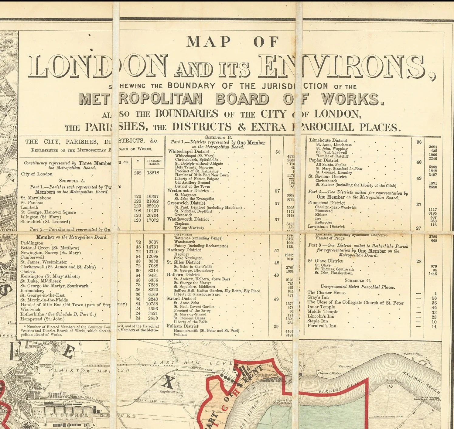
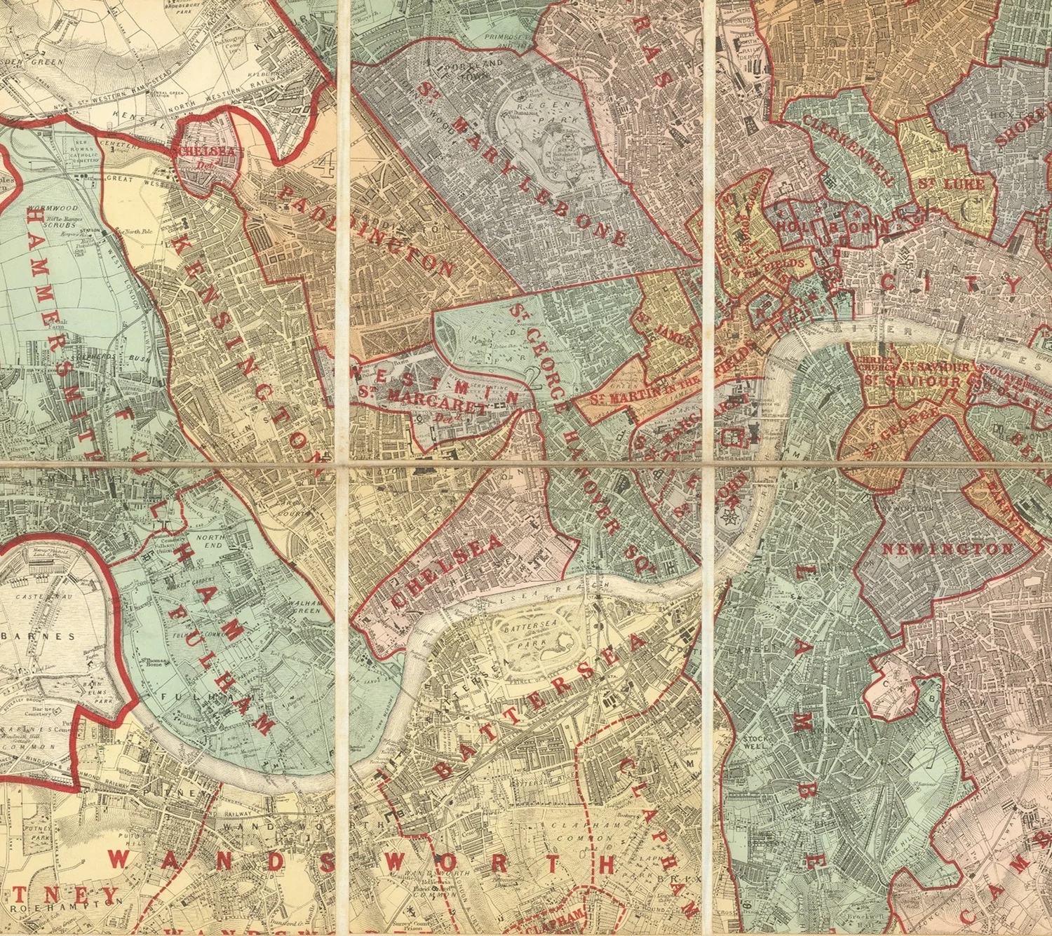
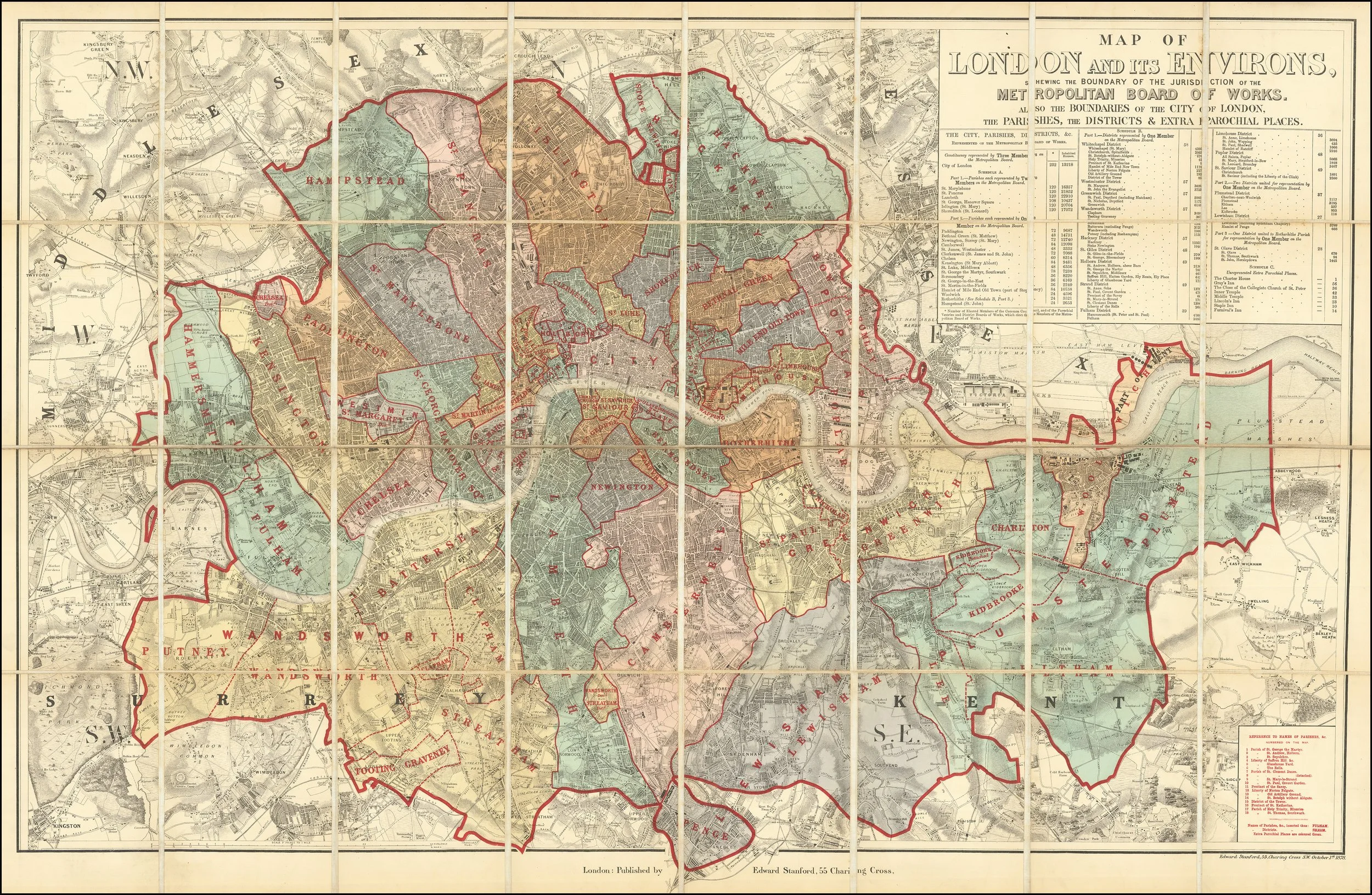
Title: Map of London and its Environs, Shewing the Boundary of the Jurisdiction of the Metropolitan Board of Works. Also the Boundaries of the City of London, the Parishes, the Districts & Extra Parochial Places.
Cartographer/Publisher: Edward Stanford. Stanford was one of the foremost map publishers in Victorian Britain; his firm became known for high-quality, authoritative maps and atlases.
Publication Place: London, England.
Colour: Hand coloured.
Edition: First state (of two), with a later edition issued in 1884.
Coverage: Greater London — showing administrative boundaries of the Metropolitan Board of Works, City of London, parishes, districts, and extra-parochial areas.
This map was produced at a moment when London was undergoing rapid expansion and administrative re-organization. In the late 19th century there was increasing demand for accurate urban mapping reflecting civic and parish jurisdictions.
Stanford’s large folding maps were widely used by officials, businesses, and scholars.
The detailed administrative boundaries distinguish it from many commercially produced city plans of the time.
According to OCLC WorldCat records, only two institutional holdings of the 1878 edition are listed:
- Institute of Historical Research (London)
- University of Adelaide (Australia
This suggests the first state is quite scarce in libraries and archives.
The 1884 re-edition is also uncommon but generally more available.
PRICE: £2,800


