An Exceptionally Rare and Important early 18th Century Plan of Paris, Louis XIV’s Paris & Versailles at the Height of His Reign


[Click image to view in new window, left or right arrow to see previous or next image.]
An Exceptionally Rare and Important early 18th Century Plan of Paris, Louis XIV’s Paris & Versailles at the Height of His Reign
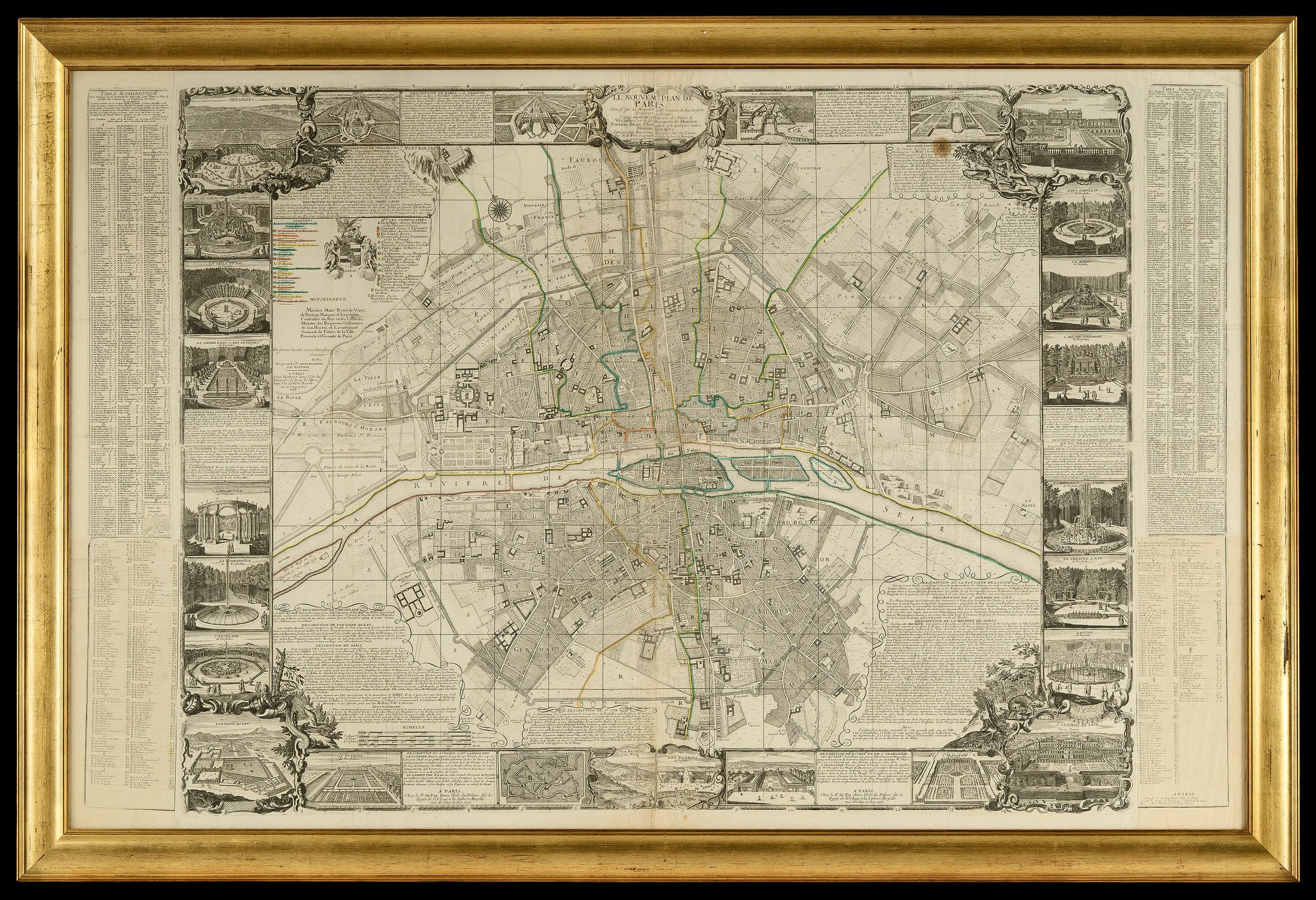
Le Nouveau Plan de Paris.
Dressé sur les Mémoires de Mr. Jouvin de Rochefort, Trésorier de France, corrigé, augmenté, et enrichi de vues de Versailles situées aux environs, dressées sur les lieux.
By Nicolas de Fer.
Paris, 1705 (variant edition).
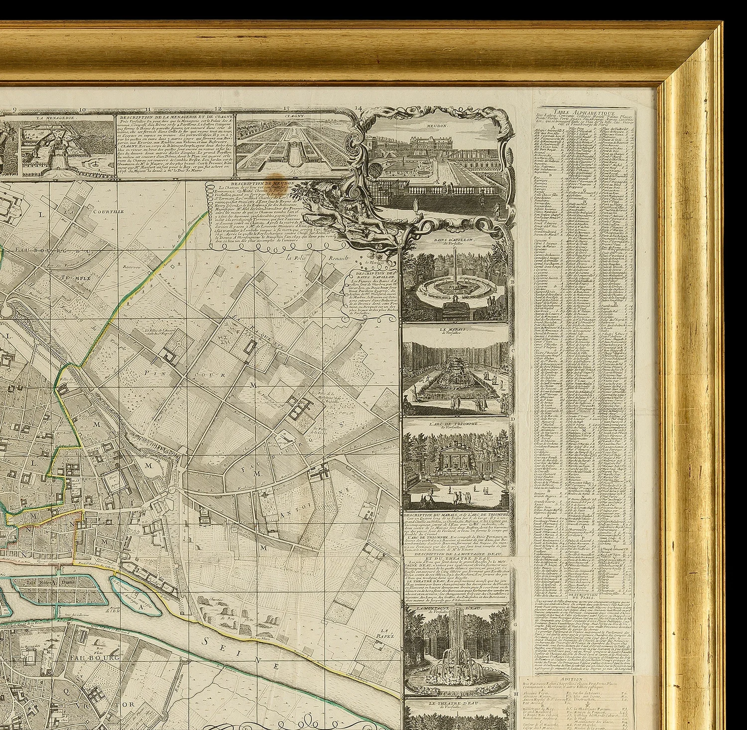
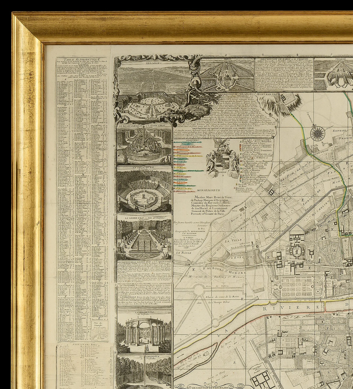
A rare variant of the 1705 edition of Nicolas de Fer’s monumental Nouveau Plan de Paris, first issued in 1697, this expansive and intricately engraved work presents a richly detailed vision of Paris alongside the royal domain of Versailles at the height of French Baroque grandeur.
This edition is distinguished by the inclusion of 24 finely executed inset views depicting Versailles and its surrounding estates, offering a comprehensive visual record of royal architecture, landscape design, and courtly life in the early 18th century. The present example is further enhanced by the presence of both original side text panels and a rare supplementary “Addition des Rues” pasted into the lower sections of each column—an exceptionally uncommon feature.
The plan extends beyond a conventional city map, functioning as a visual encyclopedia of royal power and artistic ambition. Versailles and its associated estates are prominently featured, including Marly, Trianon, and the Menagerie, famed for its display of exotic animals. Detailed vignettes capture the grandeur of the gardens and hydraulic innovations, such as the Bains d’Apollon, the Théâtre d’Eau, the Latona Fountain, and the Machine de Marly, which supplied water to the vast ornamental grounds.
Additional royal sites include Saint-Germain-en-Laye, the birthplace of Louis XIV; the Château de Clagny; Meudon; and the educational of Saint-Cyr. Other notable features include the Potager du Roi, the forest palace of Fontainebleau, the Colonnade, the Galerie d’Eau, and the Grand Canal, all illustrating the scale and sophistication of royal patronage.
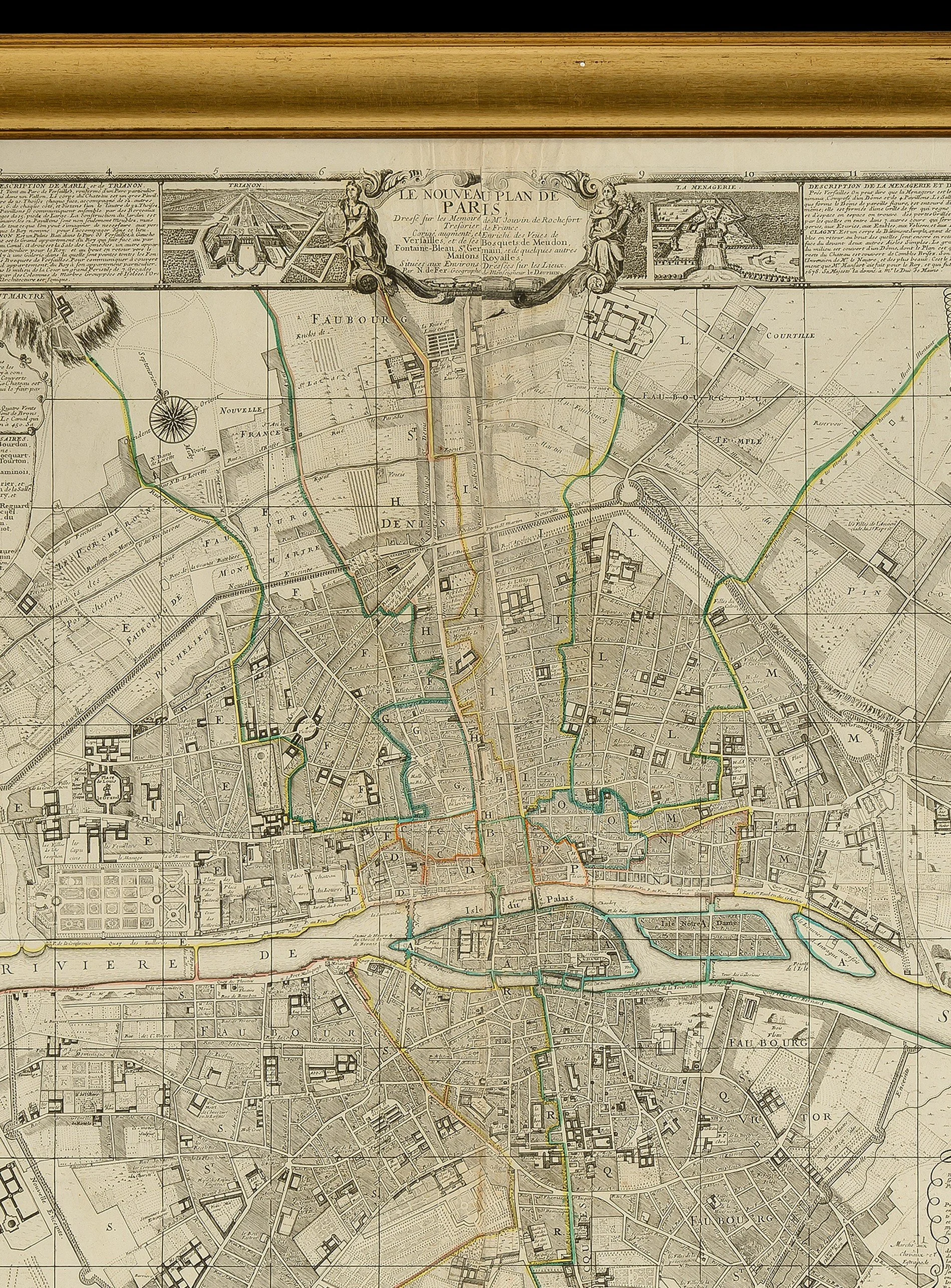
Within Paris itself, De Fer documents contemporary urban developments and commemorations of royal power, such as the Place des Victoires (1685) and the Place des Conquêtes (later Place Vendôme). The map also records planned and evolving urban forms, including the tree-lined Nouvelle Enceinte, which would later become the Grands Boulevards.
Historical Context: The Creation of Versailles.
The origins of Versailles date to 1623, when Louis XIII constructed a modest hunting lodge near the village of Versailles, approximately 12 miles west of Paris. Expanded between 1631 and 1634 by architect Philibert Le Roy, the site remained relatively restrained during his lifetime.
Following Louis XIII’s death in 1643, the regency of Anne of Austria and the upheavals of the Fronde (1648–1653) deeply influenced the young Louis XIV, shaping his determination to consolidate royal authority. After assuming personal rule in 1661, he embarked on an ambitious transformation of Versailles into the principal seat of power.
Inspired in part by the magnificence of Nicolas Fouquet’s Château de Vaux-le-Vicomte, Louis XIV enlisted the leading artistic talents of the age—architect Louis Le Vau, landscape designer André Le Nôtre, and painter Charles Le Brun—to realize his vision. Under the administrative direction of Jean-Baptiste Colbert, Versailles evolved into an unparalleled symbol of absolutism.
Major phases of construction included the expansion of the palace envelope (1668–69), the addition of grand interiors and service wings, and later the creation of iconic features such as the Hall of Mirrors under Jules Hardouin-Mansart. Despite interruptions caused by late 17th-century wars, development continued into the early 18th century, culminating in the completion of the royal chapel in 1710.
Subsequent monarchs, Louis XV and Louis XVI, focused primarily on interior refinements rather than large-scale expansion. The palace remained the center of royal life until 1789, when the French Revolution forced the royal family’s departure.
Rarity:
This plan is very rare on the market. The present example, complete with side text panels and the additional “Addition des Rues”, is of exceptional rarity; no comparable example has been located.
Dimensions:
Height: 106.8 cm
Width: 158.9 cm
PRICE: £14,800


