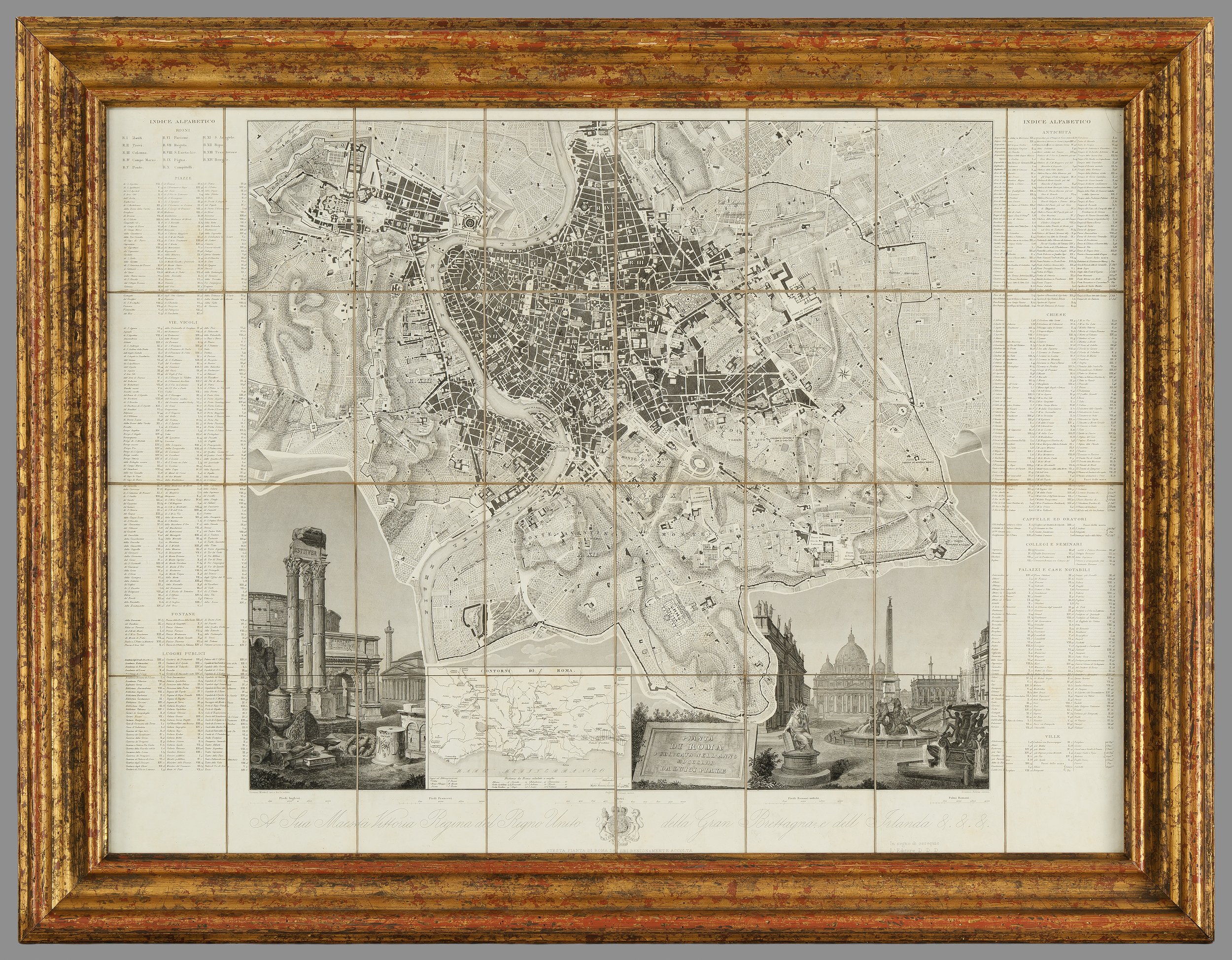
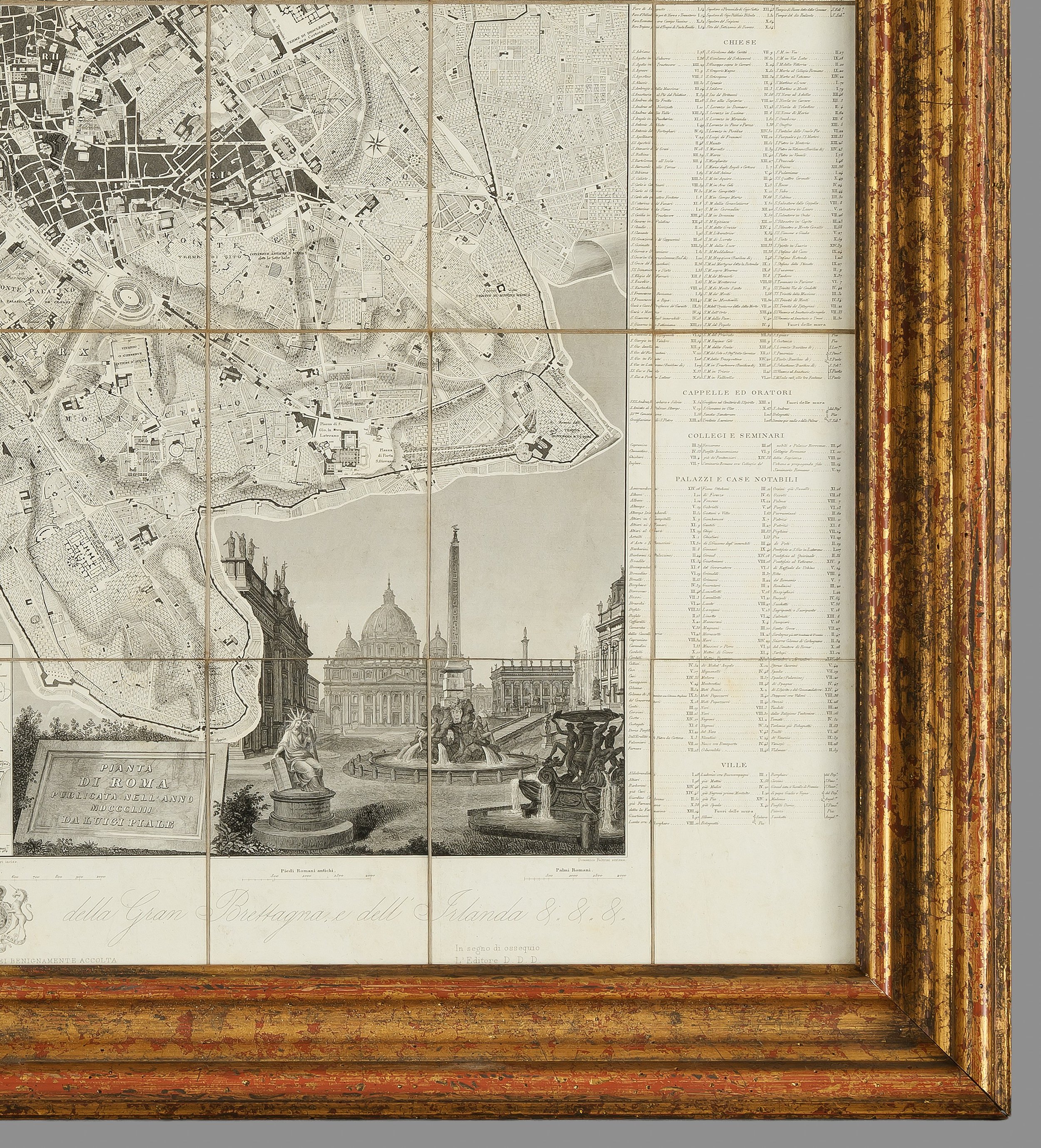
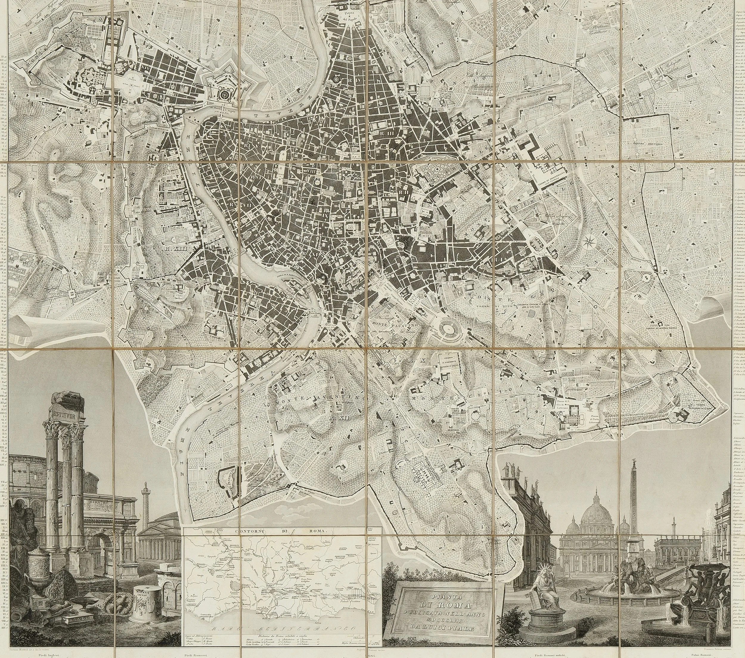
An Original Early 19th Century Map of Rome


[Click image to view in new window, left or right arrow to see previous or next image.]
An Original Early 19th Century Map of Rome
Dimensions (framed):
Height: 81.6 cm
Width: 105.5 cm
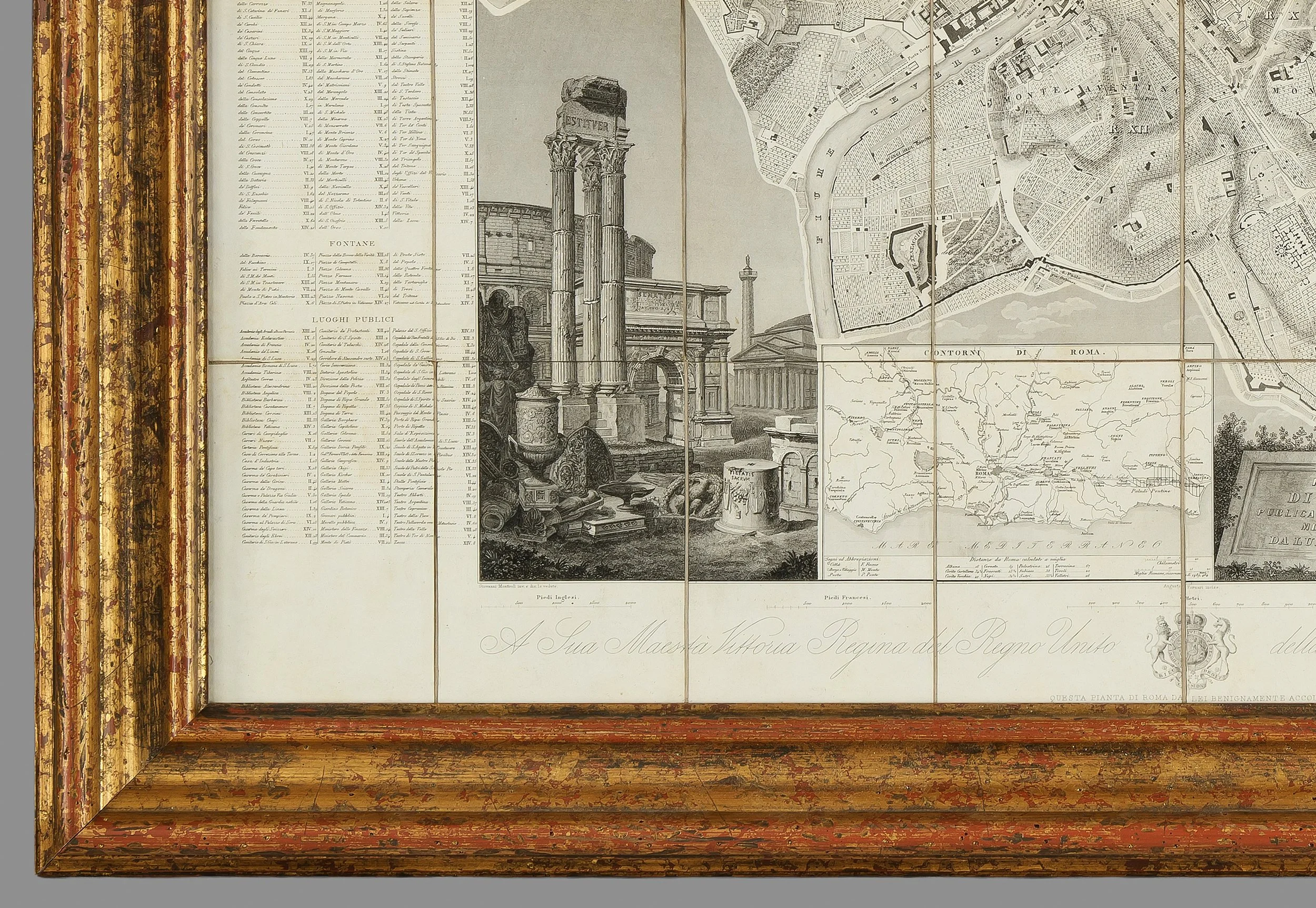
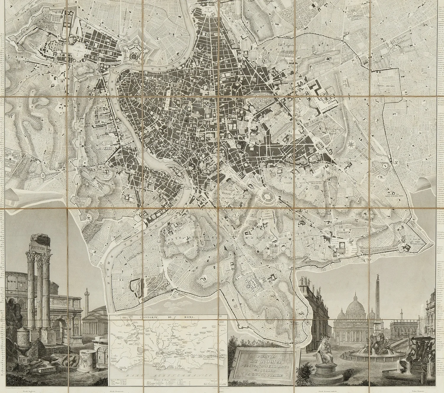
A striking and authentic early 19th century engraved map of Rome, rich in historical detail and charm. This piece features a comprehensive index on both sides, offering an insightful guide to the city’s layout during the period.
Beautifully enhanced with an engraved vignette depicting Rome’s most iconic historical landmarks, the map captures the grandeur and architectural heritage of the Eternal City.
PRICE: £2,800


