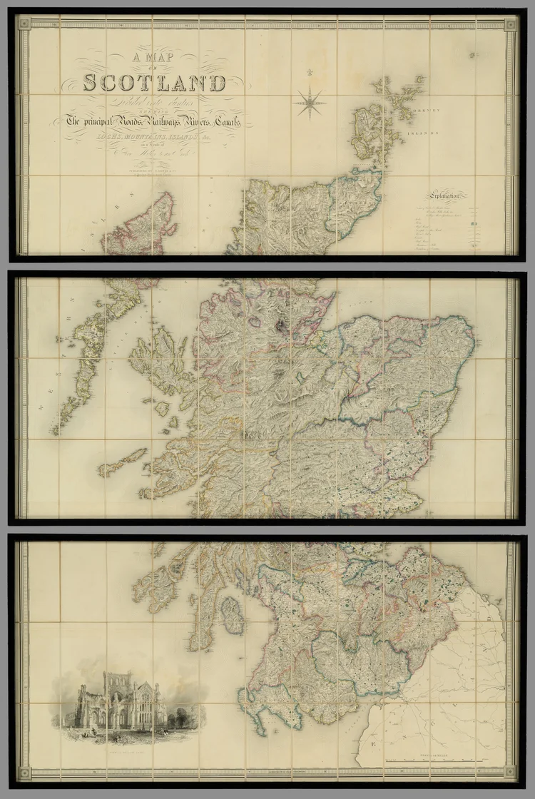
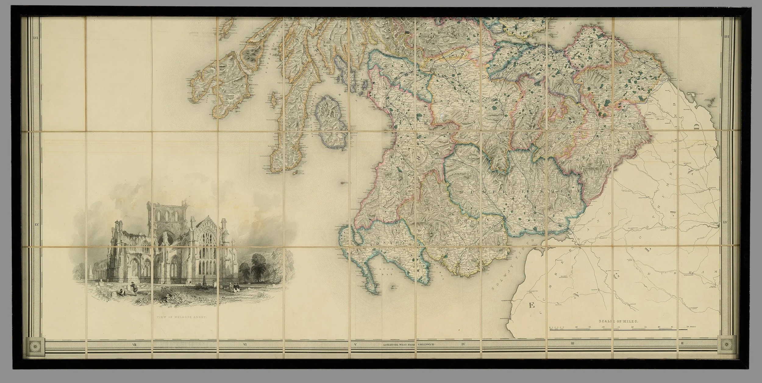
A Large Mid-19th Century Wall Map of Scotland


[Click image to view in new window, left or right arrow to see previous or next image.]
A Large Mid-19th Century Wall Map of Scotland
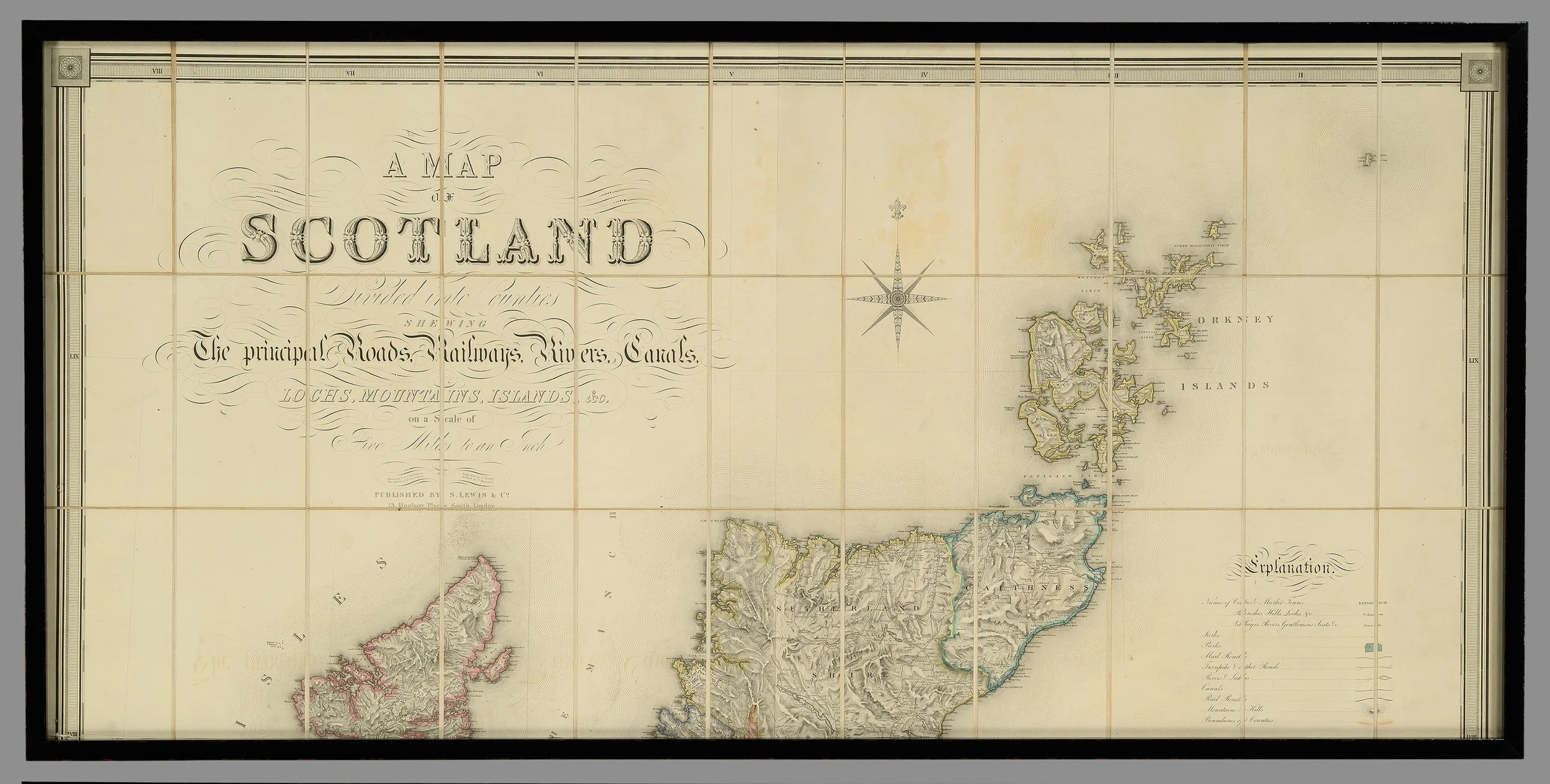
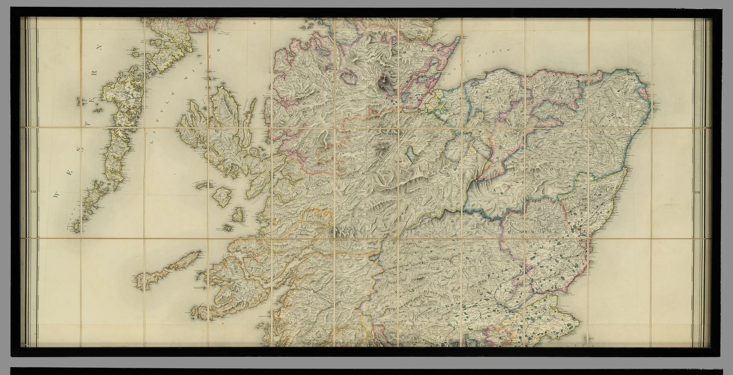
An impressive and highly decorative mid-19th century wall map of Scotland, featuring beautiful original hand colouring that has aged with great character and charm.
The map provides a detailed and comprehensive view of the country, illustrating principal roads, railways, rivers, canals, lochs, mountains, and surrounding islands. A finely rendered vignette of Melrose Abbey adds visual interest and historical appeal.
Complete with a scale in miles, this piece combines both cartographic significance and decorative presence, making it ideal for collectors, interior display, or historical enthusiasts.
Dimensions:
Height: 202 cm
Width: 137 cm
PRICE: £3,300


