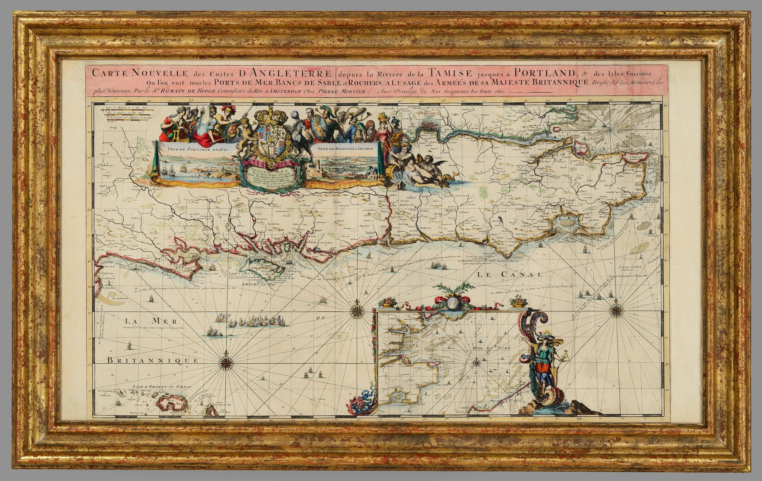
Rare and Important Late 17th-Century Map of South-East England


[Click image to view in new window, left or right arrow to see previous or next image.]
Rare and Important Late 17th-Century Map of South-East England
Romeyn de Hooghe & Pierre Mortier, Amsterdam, 1693
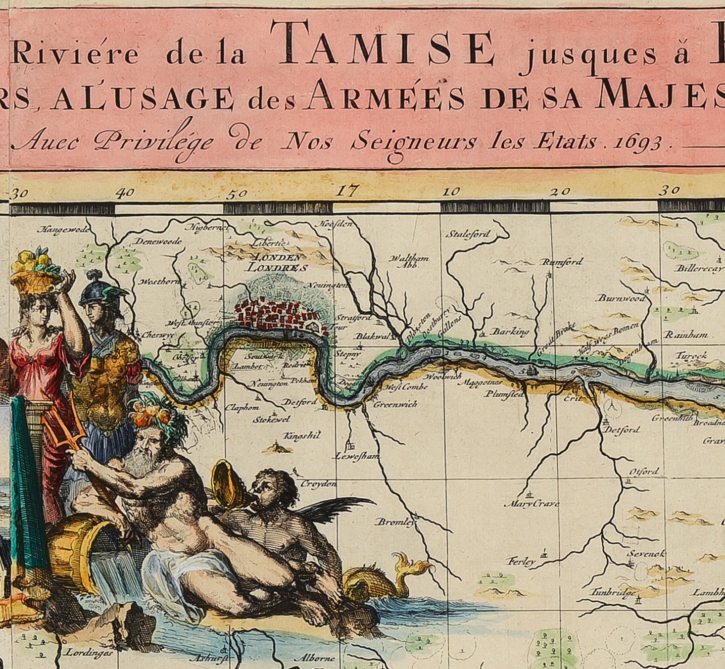
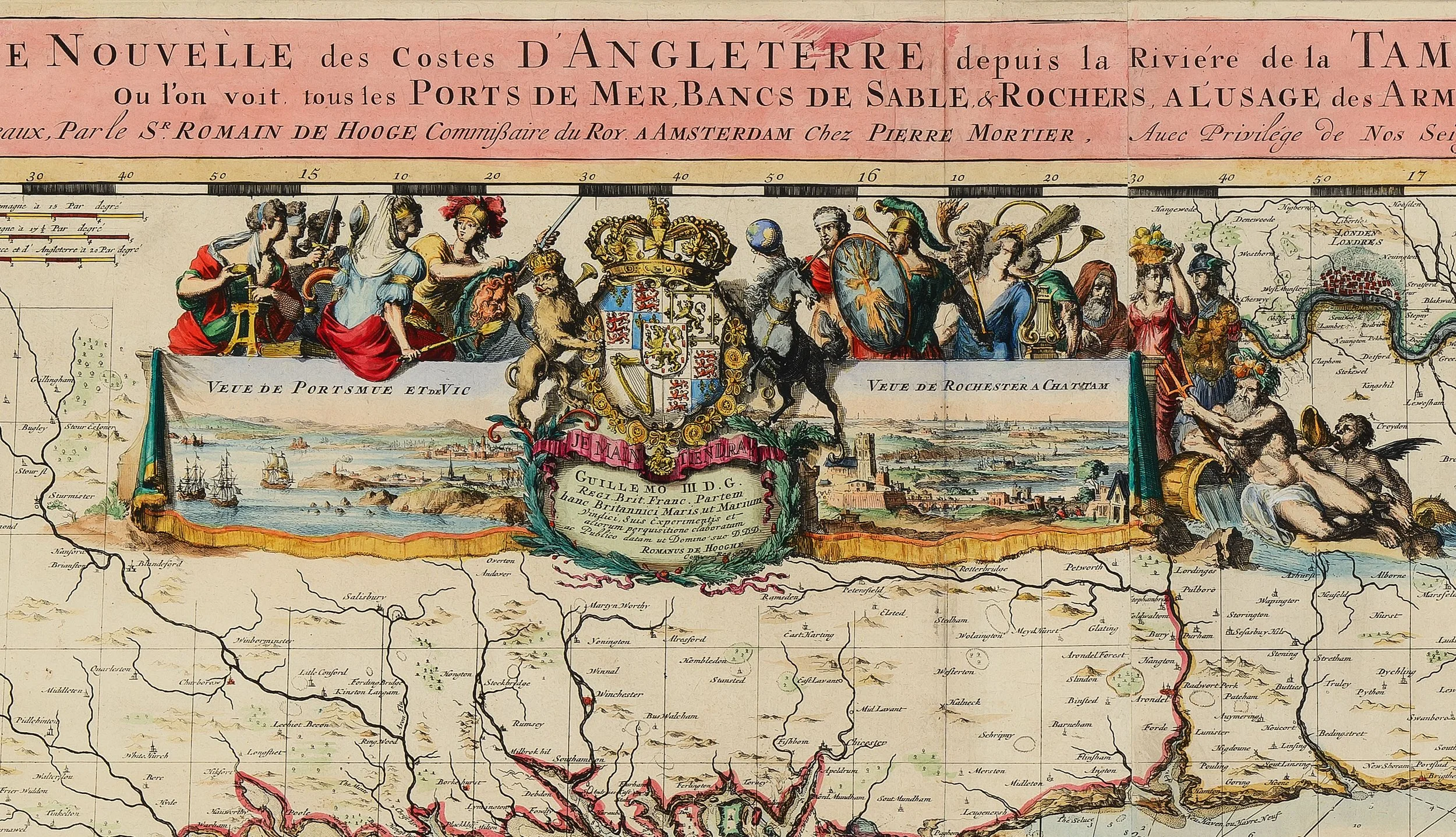
An exceptionally fine and rare late 17th-century engraved sea chart of South-East England, including London and the Thames, extending along the coast to Portland and encompassing the Isle of Wight and Alderney.
This impressive map, engraved by Romeyn de Hooghe and published by Pierre Mortier in Amsterdam, was produced in the political aftermath of the Glorious Revolution and celebrates the accession of William of Orange as King William III of England, ruling jointly with his wife Mary II from 1689.
Description:
The chart depicts the Thames estuary leading upriver to London, with detailed coastal soundings, navigational information, and decorative cartouches. It is further enhanced by:
An inset chart of the Strait of Dover
Prospect views of Portsmouth and Rochester & Chatham.
The map is finely engraved and retains its original hand colouring, which remains vibrant and well preserved.
Condition:
Excellent overall condition.
Original hand colouring.
Professionally framed in an elegant gilt frame.
Dimensions (framed):
Height: 75 cm
Width: 110 cm
Historical Significance:
Romeyn de Hooghe (1645–1708) was one of the most important graphic artists of the Dutch Golden Age, renowned for his political caricatures and propagandistic prints supporting William of Orange against Louis XIV of France. His work played a crucial role in shaping public opinion during one of Europe’s most turbulent political periods.
Pierre Mortier (1661–1711), a leading Amsterdam cartographer and publisher, was instrumental in disseminating high-quality maps throughout Europe, often combining technical accuracy with strong political messaging.
Provenance & Importance:
Maps by De Hooghe are scarce, particularly examples of this size, quality, and condition. This chart represents not only a significant navigational document but also a powerful piece of late 17th-century political propaganda tied directly to one of the most important constitutional moments in British history.
PRICE: £4,400


