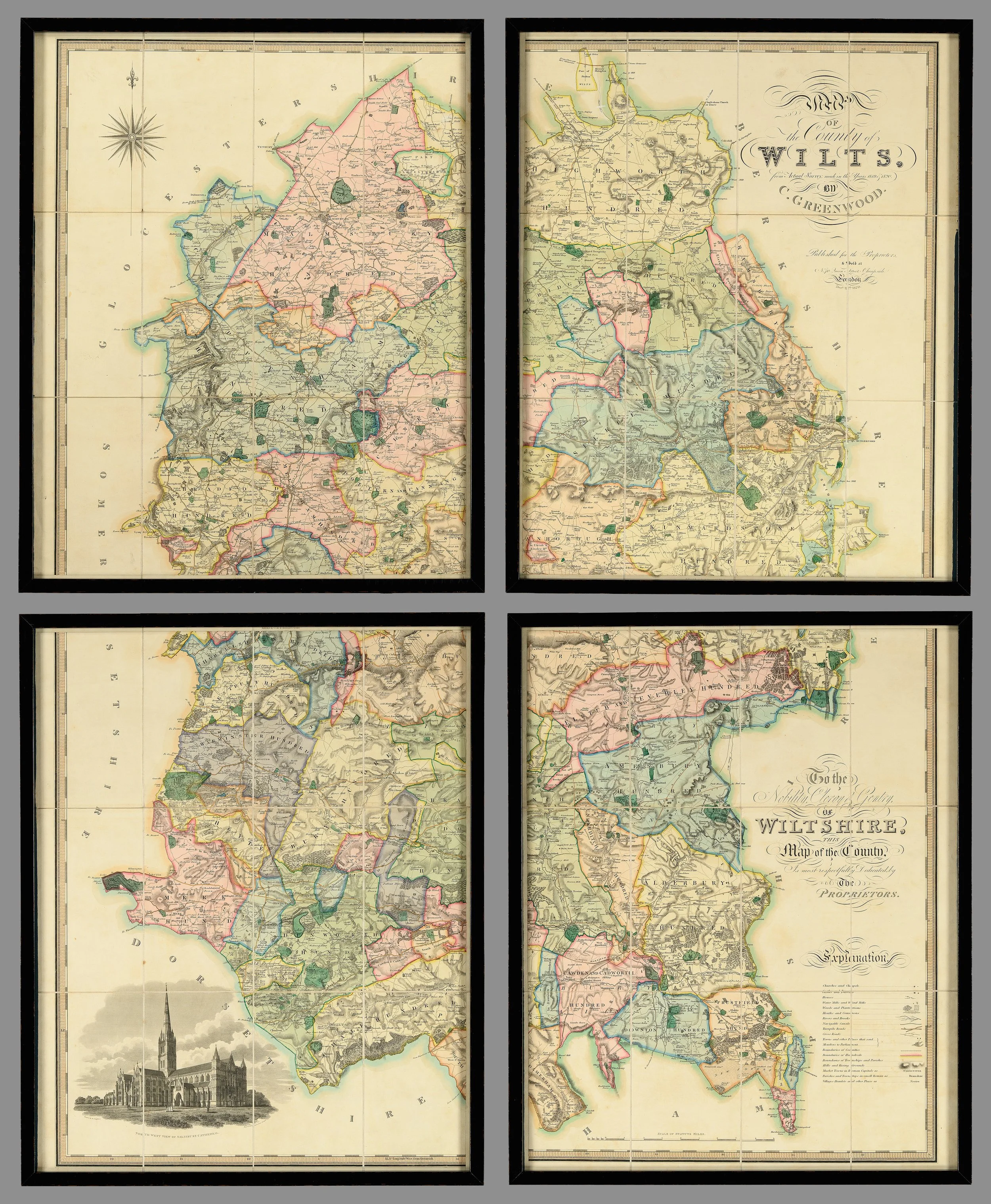
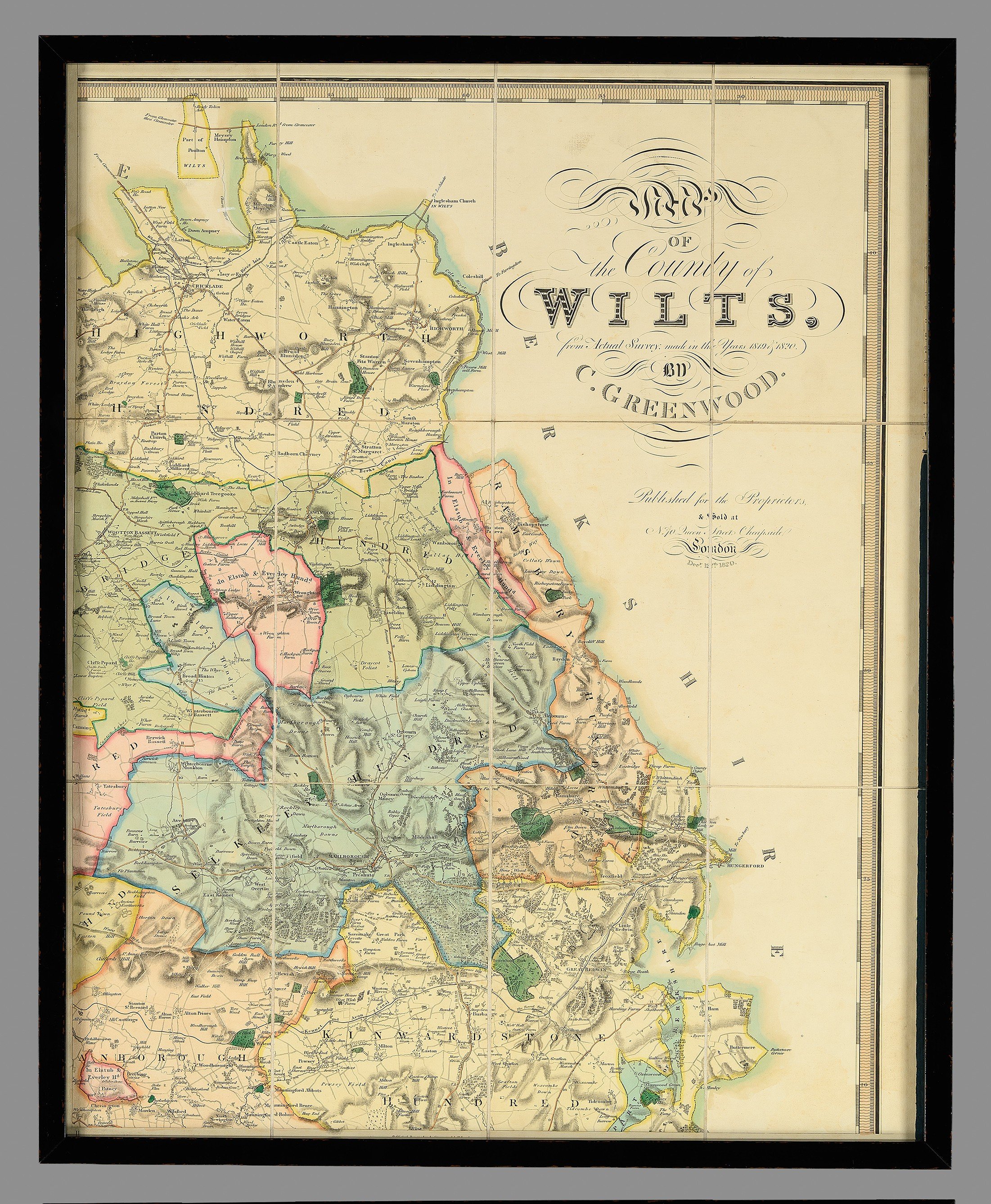
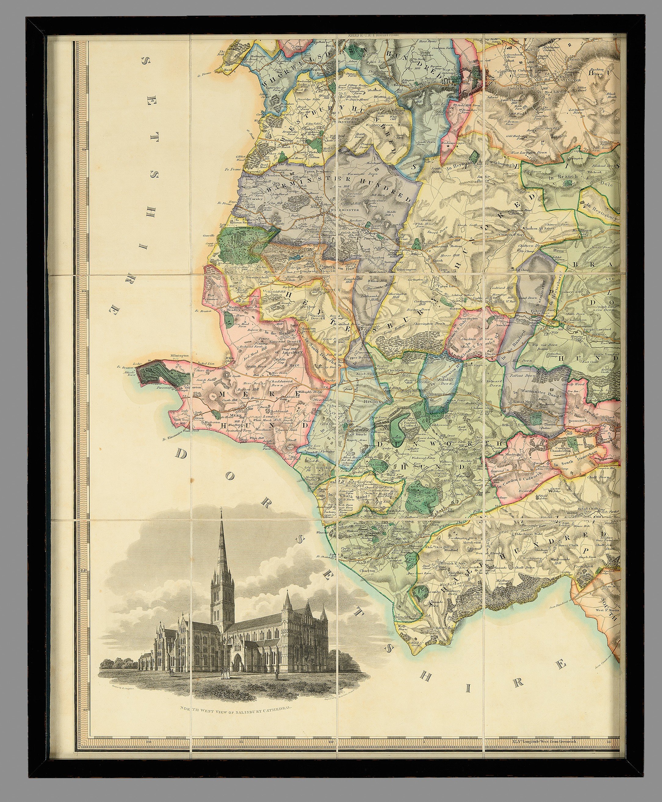
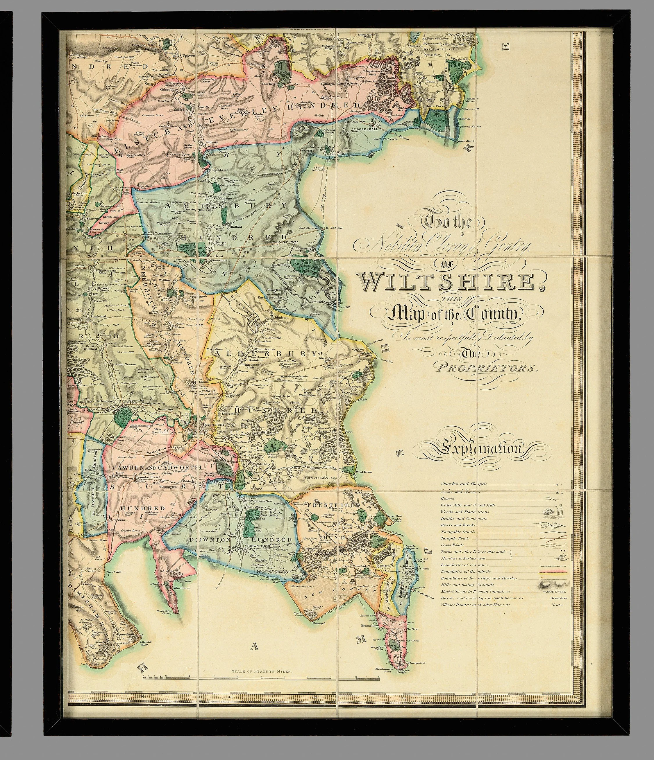
A Large Early 19th Century Wall Map of Wiltshire (1820)


[Click image to view in new window, left or right arrow to see previous or next image.]
A Large Early 19th Century Wall Map of Wiltshire (1820)
A highly impressive and large-scale wall map of Wiltshire, dated 12th December 1820, produced by the renowned cartographers Christopher and John Greenwood.
Note, exceptional original condition and framed in a black lacquer frame.
This map exemplifies the exceptional surveying and engraving standards achieved in the early 19th century. The Greenwood brothers set new benchmarks in cartography, and their county maps remain among the most accurate and detailed of their time.
Beginning their ambitious project in 1817, the Greenwoods completed maps of 34 English counties by 1831. Although they did not succeed in surveying every county, their work represents a landmark in the evolution of large-scale mapping, surpassing earlier standards in technical precision while moving away from the decorative flourishes typical of 18th-century maps.
This Wiltshire map is rich in detail, meticulously depicting:
County, hundred, and parish boundaries
Churches and chapels
Castles and quarries
Farmhouses and notable country estates
Heaths, commons, and woodland
Distances between towns and parliamentary divisions.
An especially feature is the finely engraved vignette of Salisbury Cathedral in the lower left corner, adding both artistic and historical interest.
A striking and historically significant piece, ideal for collectors of antique maps, interior designers, or anyone with an appreciation for early 19th-century British cartography.
Dimensions (framed):
Height: 153.4 cm
Width: 125 cm
PRICE: £3,750


