AN INCREDIBLY RARE AND LARGE WALL MAP OF PARIS


AN INCREDIBLY RARE AND LARGE WALL MAP OF PARIS
SOLD
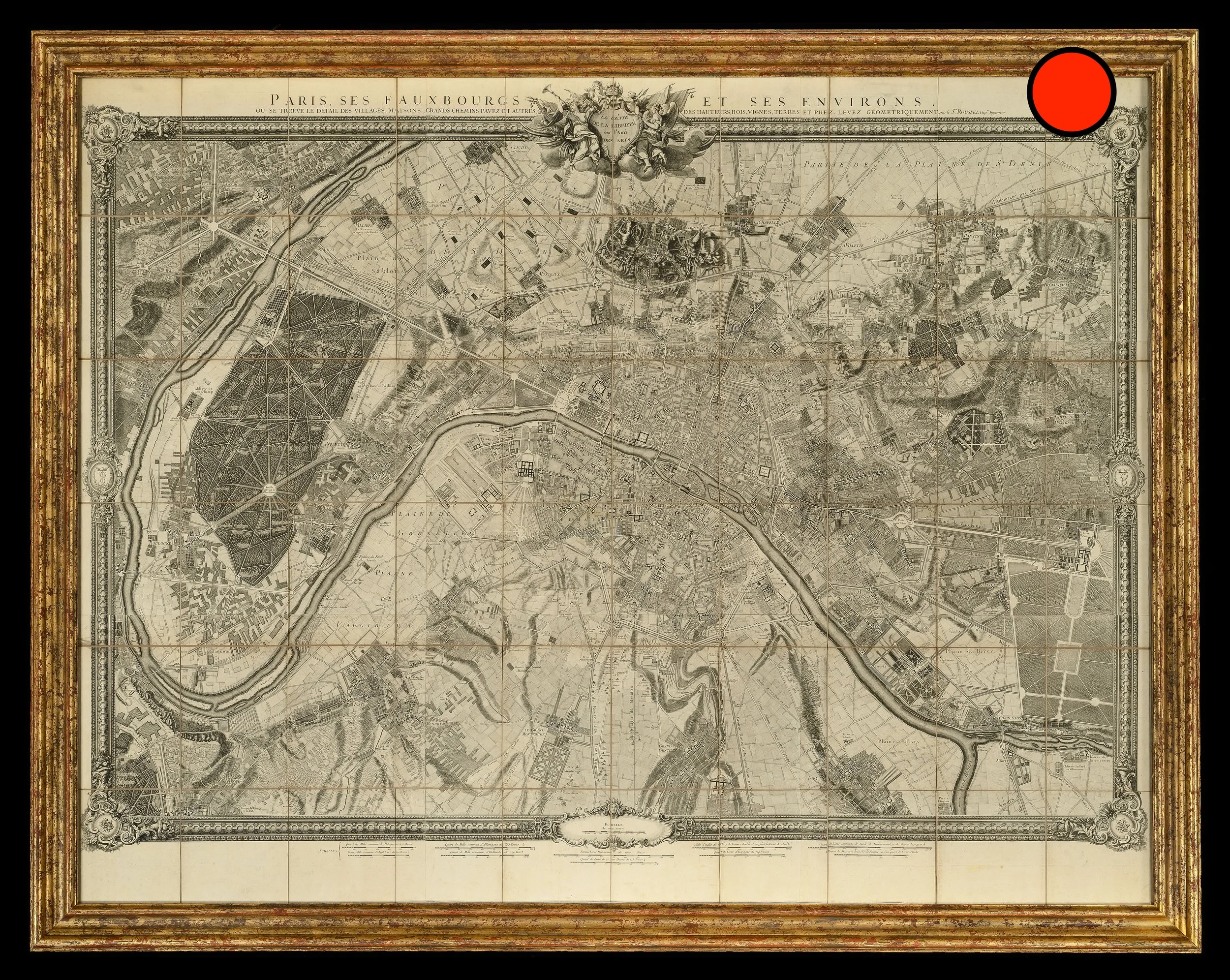
Roussel's important wall map of Paris.
Published 1844.
Note, framed in a giltwood frame.
Dimensions (framed):
Height: 155cm
Width: 195cm
The Roussel Map is the first detailed map of Paris and its inner suburbs using planar projection.
The map shows Paris and its environs, from Vincennes to the bois de Boulogne east to west, and from Saint-Denis to Bicêtre and Ivry north to south covers a territory of just over 200 square kilometers
The map was first published in 1730 and was sold by Robinot; the second edition was published in 1731 and sold by Jaillot; further examples were published later in c1756, 1765, 1795 and 1844 (this example). It represents the urban planning of the Classic period, forty years before the King's Hunting Map.


