THE FINEST 18TH-CENTURY PLAN OF ROME


[Click image to view in new window, left or right arrow to see previous or next image.]
THE FINEST 18TH-CENTURY PLAN OF ROME
BY GIAMBATTISTA NOLLI (1701 – 1756)
Published 1748.
Dimensions (Framed):
Height of main and side sections: 186.9cm
Width of main section: 220cm
Width of side sections: 51cm
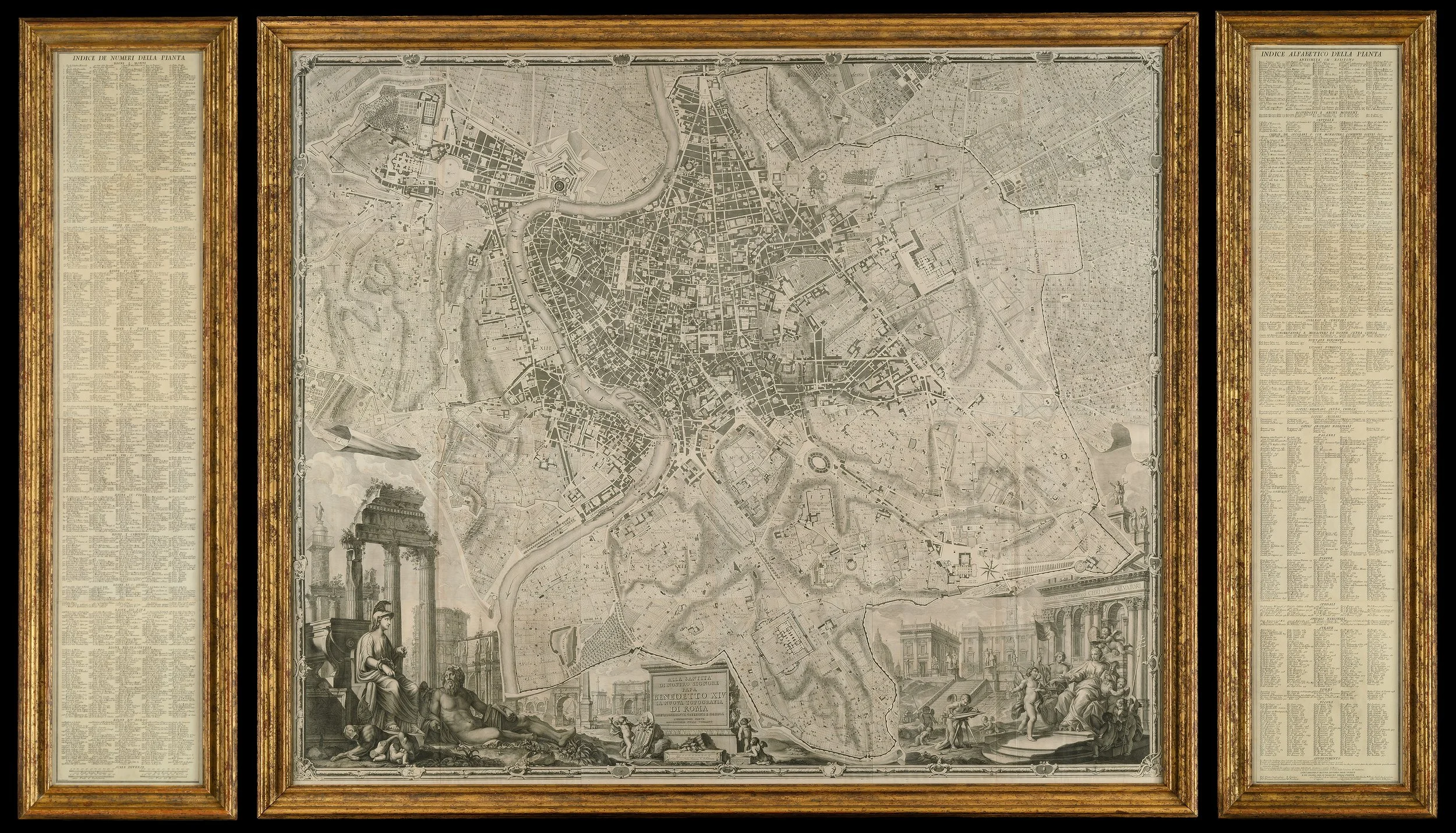
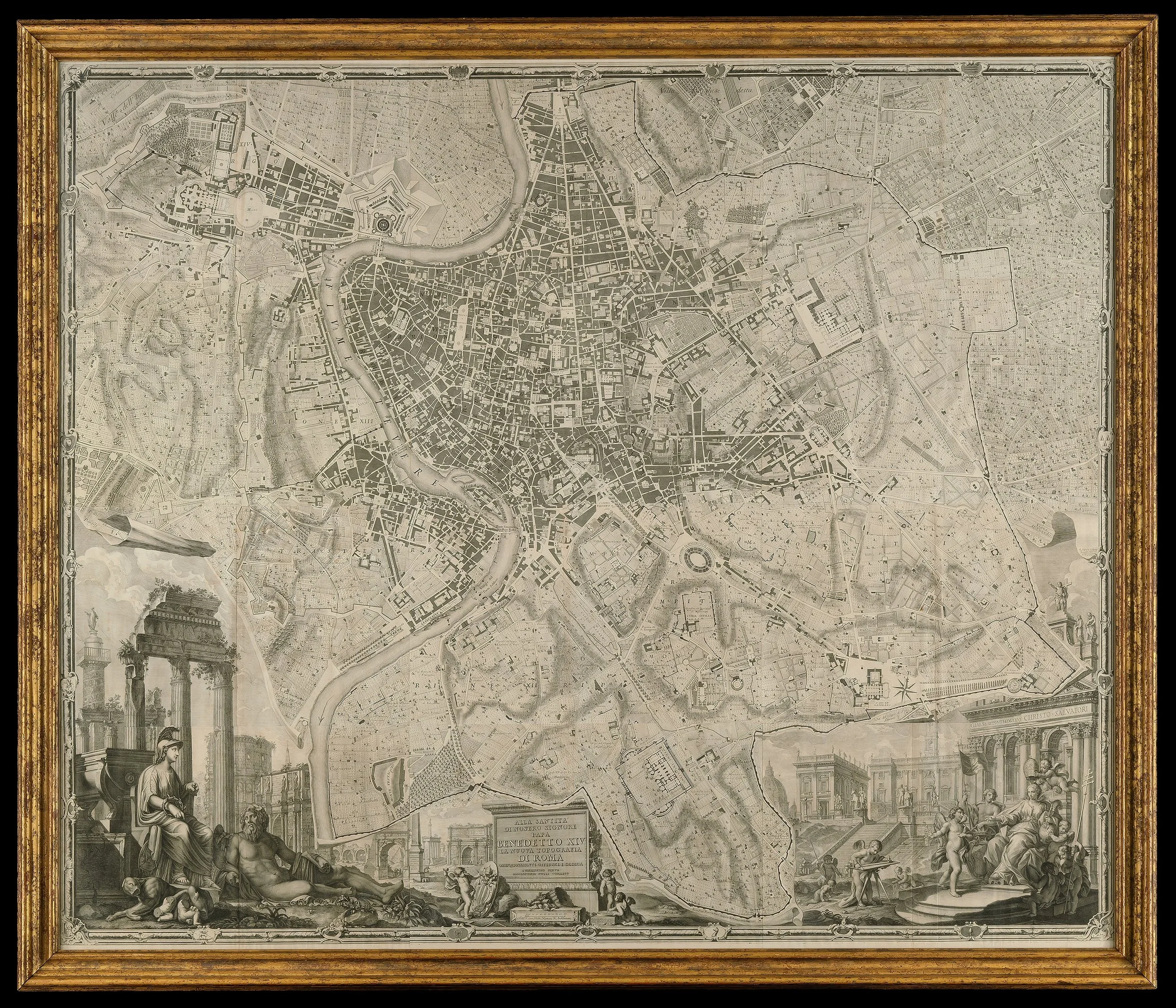
Giovanni Battista Nolli’s Nuova Pianta di Roma (1748) represents a landmark achievement in the history of cartography and urban design—arguably the most important and refined plan of Rome ever produced in the 18th century.
As noted by Jessica Maier (The Eternal City, p. 138), “Nolli’s map set a new benchmark for the scientific mapping of Rome and of all cities,” even as it catered to an elite audience of discerning collectors.
It was produced and published in response to the commission of Pope Benedict XIV to survey Rome in order to help create demarcations for the 14 traditional rioni or districts.
It was by far the most accurate description of Rome produced to date at a time when the architectural achievement of the Papacy was in full flower.
This monumental work, engraved across twelve sheets and accompanied by an extensive index of nearly 1,300 sites, stands alongside the great urban surveys of Enlightenment Europe, including Rocque’s London (1746) and Turgot’s Paris (1739). Yet Nolli’s achievement is distinguished by its extraordinary precision and methodological innovation.
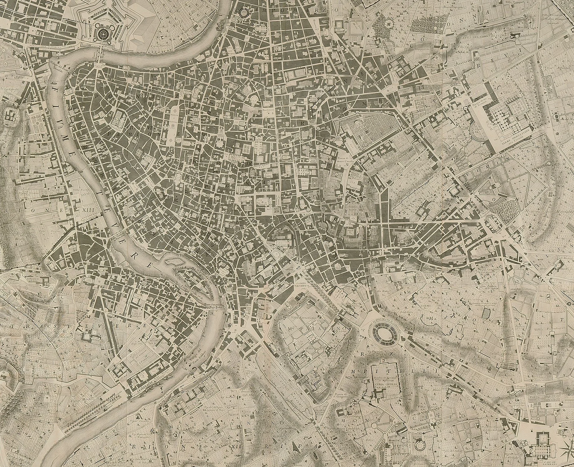
Rejecting the traditional bird’s-eye perspective, Nolli introduced a rigorously measured, ground-level representation of the city—an approach rooted in Enlightenment ideals of empirical observation and rational analysis.
Commissioned in 1736, Nolli and his team spent over a decade conducting meticulous surveys of Rome, utilizing advanced instruments and gaining unprecedented access to both public and private spaces. The result is a plan of remarkable accuracy, free from the inherited distortions that characterized earlier maps.
Its most revolutionary feature is the pioneering “figure-ground” technique: public spaces—streets, piazzas, and even church interiors—are rendered as open, unshaded areas, while private structures are shaded. This striking visual contrast not only enhances legibility but also conveys the lived experience of Rome’s urban fabric, emphasizing accessibility and spatial hierarchy in a way never before attempted.
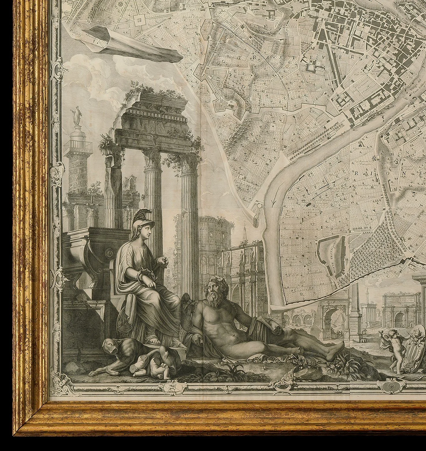
The composition is further enriched by an elaborate cartouche designed by Stefano Pozzi. This masterful decorative element celebrates Rome’s grandeur through a theatrical arrangement of classical monuments—the Colosseum, Trajan’s Column, and the Arch of Constantine—alongside allegorical figures of Romulus and Remus. Opposite, an allegory of the Church presides before Michelangelo’s Capitoline architecture, symbolizing the enduring union of Rome’s ancient heritage and ecclesiastical authority. Pozzi’s Baroque artistry provides a compelling visual counterpoint to Nolli’s scientific precision.
Beyond its aesthetic appeal, the Nuova Pianta di Roma marks a pivotal moment in the evolution of cartography. As the first map of Rome based on geodetic principles, it introduced a new level of mathematical accuracy in measuring distances and angles. Its influence extended far beyond its time, serving as an essential reference for architects, urban planners, and scholars for generations.
A masterpiece of both art and science, Nolli’s plan remains one of the most significant and desirable cartographic works of the Enlightenment era—an enduring testament to the ambition to understand and represent the city with clarity, precision, and beauty.
PRICE: £36,000


